
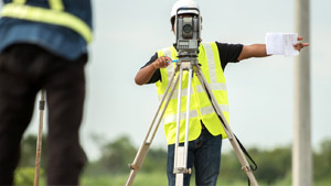
InfraNova specialise in delivering accurate surveying and civil engineering data services that lay the groundwork for smarter, faster, and safer project execution.
We provide a full suite of survey types tailored to every phase of your project including, but not limited to:
To map out natural and man-made features with pinpoint accuracy — perfect for planning, design, and earthwork calculations.
To define legal land limits and avoid costly disputes.
To determine the condition of pavement assets.
To determine the condition of drainage assets.
To ensure every structure is built exactly to spec, and every milestone is documented.
To uncover what lies beneath, from soil conditions to groundwater profiles — essential for stable foundations.
For high-resolution, rapid data collection over large or complex areas — minimising time on site while maximising detail.
To locate underground services and avoid expensive surprises during excavation.
To track movement or settlement over time — protecting your assets and reputation.
We combine cutting-edge technology, industry-leading accuracy, and expert analysis to give civil engineers, developers, and infrastructure teams the data they need — on time, every time.
From the ground up, we help you build with certainty.